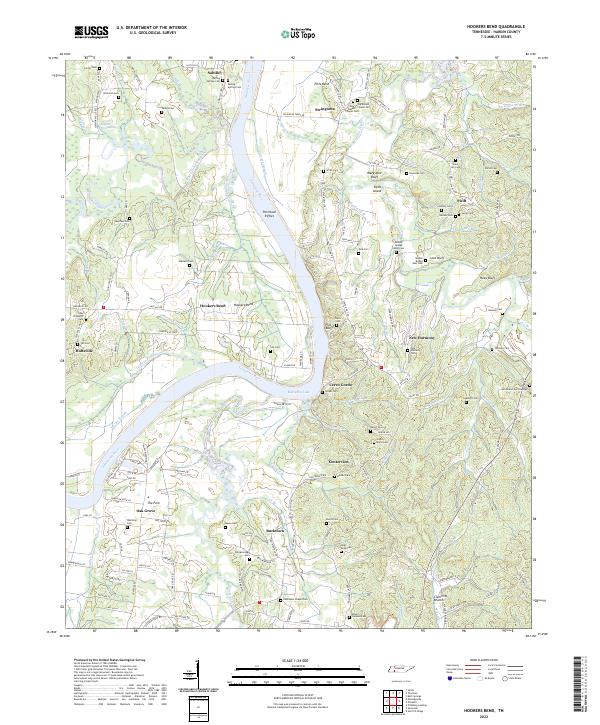
2022 Map of Hookers Bend
USGS Topo · Published 2022About this map
Saltillo and Cerro Gordo anchor the riverfront of Hardin County on this modern survey, where the Tennessee River transitions into the expanse of Kentucky Lake. The landscape is defined by the sharp bends of the river, most notably the eponymous Hookers Bend and Pitts Bend, alongside intricate wetland features like Cypress Slough and Maple Slash Slough. The density of family and community burial sites, including Boiling Springs Cem, New Harmony Cem, and McCasland Cem Number 1, provides an exceptionally detailed map for genealogists tracing ancestral homesteads near the water.
Find a feature on this map
174 named features on this map. Tap any name to fly to it.
Don’t see what you’re looking for? This feature index may not catch every label — zoom into the map to look around manually.
Map Details
Editions of this 2022 Hookers Bend Map
This is the sole edition of this map. No revisions or reprints were ever made.
Other maps of this area

1936 · Savannah
USGS Topo · 1:24,000

1936 · Wolf Pit Ridge
USGS Topo · 1:24,000

1936 · Hookers Bend
USGS Topo · 1:24,000

1936 · Thurman
USGS Topo · 1:24,000

1936 · Olivehill
USGS Topo · 1:24,000

1936 · Bath Springs
USGS Topo · 1:24,000

1936 · Sardis
USGS Topo · 1:24,000

1936 · Milledgeville
USGS Topo · 1:24,000

1936 · Pittsburg Landing
USGS Topo · 1:24,000

1949 · Hookers Bend
USGS Topo · 1:24,000