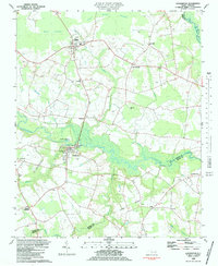
1982 Map of Hookerton
USGS Topo · Published 1983About this map
Contentnea Creek winds through the heart of this coastal plain landscape, defining the geography of eastern North Carolina in the early 1980s. The town of Hookerton serves as a central hub, situated near the creek's edge where Mt Calvary Ch and Star of Zion Ch reflect the area's deep-rooted community life. North of the water, the terrain is characterized by expansive pocosin wetlands, including Moon Pocosin and Rices Pocosin, which contrast with the grid of rural roads connecting small settlements like Maury, Ormondsville, and Fourway. The agricultural and educational infrastructure of the period is evident at East Greene Sch, while numerous family and community cemeteries (labeled simply as Cem or Cems) are scattered across the tobacco-growing region. The presence of drainage features like Mussel Run and Polecat Branch highlights the ongoing management of the low-lying, water-rich environment.
Find a feature on this map
39 named features on this map. Tap any name to fly to it.
Don’t see what you’re looking for? This feature index may not catch every label — zoom into the map to look around manually.
Map Details
Editions of this 1982 Hookerton Map
This is the sole edition of this map. No revisions or reprints were ever made.
Other maps of this area

1902 · Ayden
USGS Topo · 1:62,500

1903 · Winterville
USGS Topo · 1:62,500

1904 · Ayden
USGS Topo · 1:62,500

1904 · Falkland
USGS Topo · 1:62,500

1905 · Winterville
USGS Topo · 1:62,500

1914 · Kinston
USGS Topo · 1:48,000

1916 · Kinston
USGS Topo · 1:62,500

1953 · Rocky Mount
USGS Topo · 1:250,000

1954 · Rocky Mount
USGS Topo · 1:250,000
1981 · Farmville
USGS Topo · 1:24,000