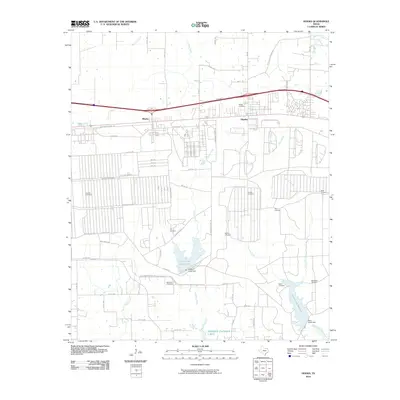
2010 Map of Hooks
USGS Topo · Published 2010About this map
Hooks and the nearby settlement of Whaley are defined by a complex grid of patrol and arterial roads, reflecting the area's organized infrastructure in the early 21st century. The landscape is notably dense with family and community burial grounds, including Wilder Cemetery, Antioch Cemetery, and Runnels Cemetery, which serve as vital markers for local genealogical research. This proximity of numerous small cemeteries suggests a deeply rooted residential history even as modern developments like Caney Creek Reservoir and Elliott Creek Reservoir have altered the drainage patterns of Jones Creek and Nettles Creek. The southern portion of the quadrangle is dominated by the expansive waters of Wright Patman Lake, where the Elliott Creek Dam and Caney Creek Dam regulate the flow of the region's prominent tributaries.
Find a feature on this map
71 named features on this map. Tap any name to fly to it.
Don’t see what you’re looking for? This feature index may not catch every label — zoom into the map to look around manually.
Map Details
Editions of this 2010 Hooks Map
This is the sole edition of this map. No revisions or reprints were ever made.
Other maps of this area

1909 · New Boston
USGS Topo · 1:62,500

1909 · Texarkana
USGS Topo · 1:62,500

1950 · Redbank
USGS Topo · 1:24,000

1950 · Barkman
USGS Topo · 1:24,000

1951 · Redbank
USGS Topo · 1:24,000

1951 · Barkman
USGS Topo · 1:24,000

1951 · Daniels Chapel
USGS Topo · 1:24,000

1953 · Texarkana
USGS Topo · 1:250,000

1954 · New Boston
USGS Topo · 1:24,000

1954 · Leary
USGS Topo · 1:24,000