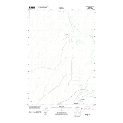
2011 Map of Hooper
USGS Topo · Published 2011About this map
Hooper and the nearby Hooper Junction anchor the southern reaches of this landscape where the Palouse River meets the winding course of Cow Creek. The area is characterized by scattered agricultural operations and ranching history, evidenced by the Bar U Ranch and the Ankeny settlement. Transport and infrastructure are central to the district, with the Gray Ranch Airport and a network of named rural routes like Mullan Rd and Old State Hwy 26 connecting the isolated farmsteads. The terrain is marked by distinctive geological features including Holliday Coulee and several small water bodies such as Lost Lake and Green Lake. This survey captures the quiet, rural character of the eastern Washington plains, documenting the specific intersections of river, rail, and road that have sustained these communities for generations.
Find a feature on this map
18 named features on this map. Tap any name to fly to it.
Don’t see what you’re looking for? This feature index may not catch every label — zoom into the map to look around manually.
Map Details
Editions of this 2011 Hooper Map
This is the sole edition of this map. No revisions or reprints were ever made.
Other maps of this area

1923 · Washtucna
USGS Topo · 1:62,500

1925 · Washtucna
USGS Topo · 1:62,500

1948 · Starbuck
USGS Topo · 1:62,500

1948 · Ayer
USGS Topo · 1:62,500

1950 · Starbuck
USGS Topo · 1:62,500

1950 · Haas
USGS Topo · 1:62,500

1950 · Benge
USGS Topo · 1:62,500

1952 · Benge
USGS Topo · 1:62,500

1953 · Walla Walla
USGS Topo · 1:250,000

1958 · Walla Walla
USGS Topo · 1:250,000