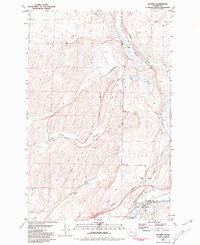
1981 Map of Hooper
USGS Topo · Published 1981About this map
Old Mullan Road cuts a historic path through this landscape, tracing the path of the first major military wagon road in the Pacific Northwest. This survey reflects a region defined by its rugged topography and transportation network, where the Burlington Northern Pacific railroad follows the winding course of Cow Creek toward its confluence with the Palouse River. The settlement of Hooper serves as a focal point near the county line, accompanied by Hooper Junction and the Hooper (Siding), highlighting the area's significance as a rail corridor.
Find a feature on this map
25 named features on this map. Tap any name to fly to it.
Don’t see what you’re looking for? This feature index may not catch every label — zoom into the map to look around manually.
Map Details
Editions of this 1981 Hooper Map
This is the sole edition of this map. No revisions or reprints were ever made.
Other maps of this area

1923 · Washtucna
USGS Topo · 1:62,500

1925 · Washtucna
USGS Topo · 1:62,500

1948 · Starbuck
USGS Topo · 1:62,500

1948 · Ayer
USGS Topo · 1:62,500

1950 · Starbuck
USGS Topo · 1:62,500

1950 · Haas
USGS Topo · 1:62,500

1950 · Benge
USGS Topo · 1:62,500

1952 · Benge
USGS Topo · 1:62,500

1953 · Walla Walla
USGS Topo · 1:250,000

1958 · Walla Walla
USGS Topo · 1:250,000