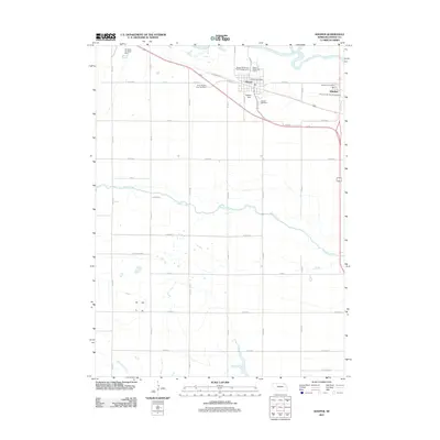
2011 Map of Hooper
USGS Topo · Published 2011About this map
The Elkhorn River meanders across the northern reaches of this Dodge County landscape, defining the topography near the established communities of Hooper and Winslow. Agricultural patterns are dictated by the paths of Maple Creek and Rawhide Creek, which cut through the fertile Nebraska plains. Significant local landmarks include the Hooper Post Office and the Winslow Post Office, serving as central hubs for these rural settlements. The map also records the presence of the Scribner Air Base Dam in the northwest corner, a remnant of regional infrastructure near the Kerstein Reservoir. For those researching local heritage, the Saint Rose of Lima Cemetery and Hooper Cemetery provide vital points of reference. The grid of county roads, such as Co Road J and Co Road 21, illustrates the enduring organization of the rural township system into the twenty-first century.
Find a feature on this map
36 named features on this map. Tap any name to fly to it.
Don’t see what you’re looking for? This feature index may not catch every label — zoom into the map to look around manually.
Map Details
Editions of this 2011 Hooper Map
This is the sole edition of this map. No revisions or reprints were ever made.
Other maps of this area

1893 · Fremont
USGS Topo · 1:125,000

1896 · Fremont
USGS Topo · 1:125,000

1899 · Wahoo
USGS Topo · 1:125,000

1955 · Fremont
USGS Topo · 1:250,000

1957 · Fremont
USGS Topo · 1:250,000

1958 · Fremont
USGS Topo · 1:250,000

1966 · Scribner SW
USGS Topo · 1:24,000

1966 · Uehling
USGS Topo · 1:24,000

1966 · Nickerson
USGS Topo · 1:24,000

1966 · Hooper
USGS Topo · 1:24,000