
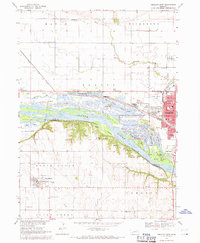
1966 Map of Nickerson
USGS Topo · Published 1967About this map
The Elkhorn River meanders through the heart of this mid-1960s Nebraska landscape, shaping the development and transportation corridors of Dodge and Washington Counties. The river valley is defined by complex oxbows and water bodies like Snyder Lake and Fish Lake, alongside man-made alterations such as the Logan Creek Dredge. Two major rail lines, the Chicago and North Western and the Chicago Burlington and Quincy, converge near the town of Nickerson, highlighting the area's importance as a shipping hub for agricultural communities.
Find a feature on this map
33 named features on this map. Tap any name to fly to it.
Don’t see what you’re looking for? This feature index may not catch every label — zoom into the map to look around manually.
Map Details
Editions of this 1966 Nickerson Map
This is the sole edition of this map. No revisions or reprints were ever made.
Other maps of this area

1893 · Fremont
USGS Topo · 1:125,000

1896 · Fremont
USGS Topo · 1:125,000

1899 · Wahoo
USGS Topo · 1:125,000

1955 · Fremont
USGS Topo · 1:250,000

1957 · Fremont
USGS Topo · 1:250,000

1958 · Fremont
USGS Topo · 1:250,000

1966 · Uehling
USGS Topo · 1:24,000

1966 · Hooper
USGS Topo · 1:24,000

1966 · Nickerson NW
USGS Topo · 1:24,000
1968 · Fremont West
USGS Topo · 1:24,000