
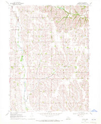
1966 Map of Nickerson NW
USGS Topo · Published 1967About this map
Three Nebraska counties—Burt, Dodge, and Washington—converge in this agricultural landscape mapped in the mid-1960s. The map reveals a high density of rural institutions that sustained these farming townships, including numerous numbered schoolhouses like School No 67 and School No 17. The spiritual and communal life of the era is anchored by landmarks such as Elim Ch and a significant concentration of burial grounds, including the West Admah Cem and Admah Cem near the Washington County line.
Find a feature on this map
25 named features on this map. Tap any name to fly to it.
Don’t see what you’re looking for? This feature index may not catch every label — zoom into the map to look around manually.
Map Details
Editions of this 1966 Nickerson NW Map
This is the sole edition of this map. No revisions or reprints were ever made.
Other maps of this area

1955 · Fremont
USGS Topo · 1:250,000

1957 · Fremont
USGS Topo · 1:250,000

1958 · Fremont
USGS Topo · 1:250,000

1966 · Oakland
USGS Topo · 1:24,000

1966 · West Point SE
USGS Topo · 1:24,000

1966 · Uehling
USGS Topo · 1:24,000

1966 · Nickerson
USGS Topo · 1:24,000

1966 · Hooper
USGS Topo · 1:24,000
1969 · Orum
USGS Topo · 1:24,000

1970 · Oakland SE
USGS Topo · 1:24,000