
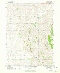
1966 Map of Oakland
USGS Topo · Published 1967About this map
Oakland serves as the primary hub of activity in this mid-1960s Nebraska landscape, where the intersection of two major rail lines—the Chicago and North Western and the Burlington and Quincy—dictated the town's development. The rural surroundings are characterized by a dense network of one-room schoolhouses, including Harmony Sch, Mt Olive Sch, and numbered districts like School No. 51, illustrating the decentralized community structure of the era.
Find a feature on this map
21 named features on this map. Tap any name to fly to it.
Don’t see what you’re looking for? This feature index may not catch every label — zoom into the map to look around manually.
Map Details
Editions of this 1966 Oakland Map
This is the sole edition of this map. No revisions or reprints were ever made.
Other maps of this area

1955 · Fremont
USGS Topo · 1:250,000

1957 · Fremont
USGS Topo · 1:250,000

1958 · Fremont
USGS Topo · 1:250,000

1966 · West Point SE
USGS Topo · 1:24,000

1966 · Uehling
USGS Topo · 1:24,000

1966 · Lyons
USGS Topo · 1:24,000

1966 · West Point NE
USGS Topo · 1:24,000

1966 · Nickerson NW
USGS Topo · 1:24,000

1970 · Oakland SE
USGS Topo · 1:24,000
1970 · Bertha
USGS Topo · 1:24,000