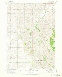
1970 Map of Bertha
USGS Topo · Published 1972About this map
Silver Creek and Bell Creek wind through the township boundaries of Decatur and Logan in this topographic study from the early 1970s. The landscape is defined by its agrarian social centers, notably the settlement of Bertha and its namesake Bertha Sch. These small rural hubs, often centered around a schoolhouse or a country church, provide a detailed look at the settlement patterns in Burt County. Educational and religious life is well-documented with sites like Elm Creek Sch, Divide Center Ch, and the Divide Center Sch. To the north, Holy Family Cem serves as a significant genealogical marker near the headwaters of Elm Creek. The map also captures the drainage patterns of Lone Tree Creek and the lone landmark of Tukamah Ch, illustrating how water and community infrastructure dictated the development of this Nebraska prairie.
Find a feature on this map
15 named features on this map. Tap any name to fly to it.
Don’t see what you’re looking for? This feature index may not catch every label — zoom into the map to look around manually.
Map Details
Editions of this 1970 Bertha Map
This is the sole edition of this map. No revisions or reprints were ever made.
Other maps of this area

1955 · Sioux City
USGS Topo · 1:250,000

1955 · Fremont
USGS Topo · 1:250,000

1957 · Fremont
USGS Topo · 1:250,000

1958 · Sioux City
USGS Topo · 1:250,000

1958 · Fremont
USGS Topo · 1:250,000

1959 · Sioux City
USGS Topo · 1:250,000

1966 · Oakland
USGS Topo · 1:24,000

1966 · Lyons
USGS Topo · 1:24,000

1966 · Walthill SW
USGS Topo · 1:24,000

1966 · Macy
USGS Topo · 1:24,000