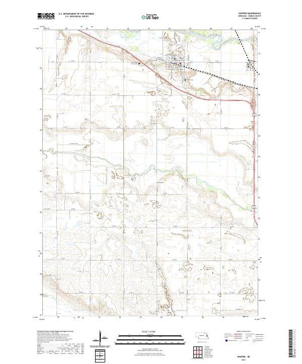
2021 Map of Hooper
USGS Topo · Published 2021About this map
Hooper and Winslow anchor this landscape in eastern Nebraska, where the Elkhorn River winds through the northern sections of the survey. The terrain is defined by the alluvial patterns of Maple Creek and Rawhide Cr, which cut through the agricultural grid. This 2021 record shows a mature rural infrastructure, including local landmarks like the Saint Rose of Lima Cem and the Hooper Cem. The presence of Brickyard Dr in Hooper suggests a connection to early local industry, while the Lower Elkhorn River Trl highlights modern recreational use along the historical river corridor. The map's detailed road network, from Rosedale Rd to numerous county routes, illustrates the enduring settlement pattern of Dodge County.
Find a feature on this map
43 named features on this map. Tap any name to fly to it.
Don’t see what you’re looking for? This feature index may not catch every label — zoom into the map to look around manually.
Map Details
Editions of this 2021 Hooper Map
This is the sole edition of this map. No revisions or reprints were ever made.
Other maps of this area

1893 · Fremont
USGS Topo · 1:125,000

1896 · Fremont
USGS Topo · 1:125,000

1899 · Wahoo
USGS Topo · 1:125,000

1955 · Fremont
USGS Topo · 1:250,000

1957 · Fremont
USGS Topo · 1:250,000

1958 · Fremont
USGS Topo · 1:250,000

1966 · Scribner SW
USGS Topo · 1:24,000

1966 · Uehling
USGS Topo · 1:24,000

1966 · Nickerson
USGS Topo · 1:24,000

1966 · Hooper
USGS Topo · 1:24,000