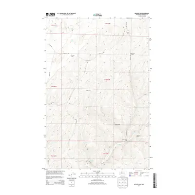
2013 Map of Hooper Lake
USGS Topo · Published 2013About this map
McGregor Ranch and the nearby Mc Gregor Airport anchor this high-plateau landscape in Whitman County, characterized by a series of deep canyons and seasonal water sources. The map details the complex drainage systems of Hooper Canyon and Woods Gulch as they cut through the dry terrain toward Alkali Flat Cr. Historically significant water points for ranching and travel are clearly marked, including Mays Spring, Goldfish Spring, and Adarrio Spring. To the northwest, a cluster of small basins contains McGregor Lakes, Clear Lake, and Hooper Lake, providing a distinct contrast to the surrounding flats. The rural infrastructure of the early 21st century is reflected in the network of local roads such as Rock Springs Rd and Thomas Flat Rd, which connect isolated agricultural holdings like the Gordon Farm.
Find a feature on this map
32 named features on this map. Tap any name to fly to it.
Don’t see what you’re looking for? This feature index may not catch every label — zoom into the map to look around manually.
Map Details
Editions of this 2013 Hooper Lake Map
This is the sole edition of this map. No revisions or reprints were ever made.
Other maps of this area

1948 · Starbuck
USGS Topo · 1:62,500

1950 · La Crosse
USGS Topo · 1:62,500

1950 · Starbuck
USGS Topo · 1:62,500

1950 · Hay
USGS Topo · 1:62,500

1950 · Benge
USGS Topo · 1:62,500

1952 · Hay
USGS Topo · 1:62,500

1952 · La Crosse
USGS Topo · 1:62,500

1952 · Benge
USGS Topo · 1:62,500

1953 · Walla Walla
USGS Topo · 1:250,000

1955 · Pullman
USGS Topo · 1:250,000