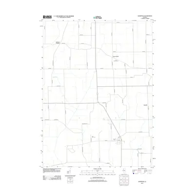
2012 Map of Hooppole
USGS Topo · Published 2012About this map
Jefferson Corners and Leon Corners anchor this rural landscape in Henry County, where the grid of sectional roads reflects a long history of agricultural settlement. The map reveals a community structured around small crossroads and family-named routes such as Countryman Rd and Mathis Rd. Evidence of local heritage is found at the Leon Methodist Cem, Saint Marys Cem, and Hooppole Cem, which serve as primary landmarks for genealogists tracing families in this corner of Illinois. The terrain is defined by low-lying drainages like the Keefer Branch, which winds through the western portion of the sheet. Modern infrastructure is represented by the north-south alignment of Illinois Route 78, passing through the heart of the area near the settlement of Aliceville.
Find a feature on this map
49 named features on this map. Tap any name to fly to it.
Don’t see what you’re looking for? This feature index may not catch every label — zoom into the map to look around manually.
Map Details
Editions of this 2012 Hooppole Map
This is the sole edition of this map. No revisions or reprints were ever made.
Other maps of this area

1899 · Clinton
USGS Topo · 1:125,000

1929 · Annawan
USGS Topo · 1:62,500

1932 · Prophetstown
USGS Topo · 1:48,000

1932 · Annawan
USGS Topo · 1:62,500

1934 · Geneseo
USGS Topo · 1:62,500

1936 · Prophetstown
USGS Topo · 1:62,500

1952 · Erie
USGS Topo · 1:62,500
1953 · Atkinson
USGS Topo · 1:24,000

1958 · Davenport
USGS Topo · 1:250,000

1958 · Aurora
USGS Topo · 1:250,000