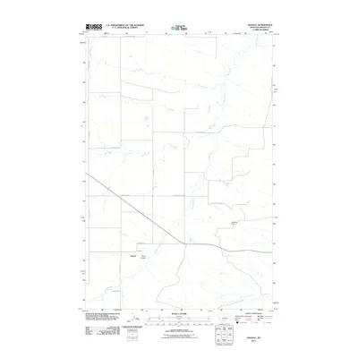
2011 Map of Hoosac
USGS Topo · Published 2011About this map
Hoosac sits within a landscape defined by an intricate network of drainages and ranch roads in Fergus County. The area is characterized by the confluence of numerous waterways, including the winding paths of Wolf Creek, Smith Creek, and Ox Creek. The terrain features distinct topographic shifts, notably at Pacer Coulee and near Osborn Spring, which provide critical water sources in this dry Montana environment. A web of local roads, such as Bear Springs Rd and Goettmoeller Rd, connects the dispersed homesteads and agricultural tracts that define the region's rural character. The presence of the Wet Mutt Dam signifies the localized water management necessary for livestock and land use in this part of the state, where the open prairie meets the more varied relief of the surrounding hills.
Find a feature on this map
20 named features on this map. Tap any name to fly to it.
Don’t see what you’re looking for? This feature index may not catch every label — zoom into the map to look around manually.
Map Details
Editions of this 2011 Hoosac Map
This is the sole edition of this map. No revisions or reprints were ever made.
Other maps of this area

1954 · Lewistown
USGS Topo · 1:250,000

1959 · Lewistown
USGS Topo · 1:250,000

1970 · Harwood Bench
USGS Topo · 1:24,000

1970 · Danvers
USGS Topo · 1:24,000
1970 · Big Spring
USGS Topo · 1:24,000
1978 · Soda Spring Coulee
USGS Topo · 1:24,000

1978 · Wild Bill Flat West
USGS Topo · 1:24,000

1978 · Toney Bench
USGS Topo · 1:24,000
1978 · Hoosac
USGS Topo · 1:24,000

1978 · Lewistown
USGS Topo · 1:100,000