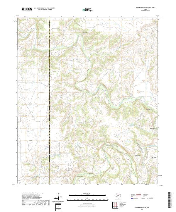
2022 Map of Hoover Mountain
USGS Topo · Published 2022About this map
Clear Fork Brazos River carves a winding path across this portion of the Texas plains, defining a landscape of sharp bends and deep canyons along the border of Haskell and Throckmorton counties. The terrain is marked by significant topographical elevations including Hoover Mtn and Round Mtn, while the river's course is punctuated by distinctive geographic features such as Turkey Bend, Burkett Bend, and Shinnery Bend. This area shows a land use pattern typical of West Texas ranching country, where natural drainage features like Buffalo Draw and Cottonwood Canyon lead to essential stock water points such as Cottonwood Tank and Buffalo Tank. The Presence of Bake Oven Flat and Round Valley suggests a complex local geography where flatlands provide a sharp contrast to the surrounding ridges.
Find a feature on this map
21 named features on this map. Tap any name to fly to it.
Don’t see what you’re looking for? This feature index may not catch every label — zoom into the map to look around manually.
Map Details
Editions of this 2022 Hoover Mountain Map
This is the sole edition of this map. No revisions or reprints were ever made.
Other maps of this area

1891 · Anson
USGS Topo · 1:125,000

1892 · Albany
USGS Topo · 1:125,000

1893 · Albany
USGS Topo · 1:125,000

1893 · Anson
USGS Topo · 1:125,000

1954 · Abilene
USGS Topo · 1:250,000

1954 · Wichita Falls
USGS Topo · 1:250,000

1958 · Wichita Falls
USGS Topo · 1:250,000

1958 · Abilene
USGS Topo · 1:250,000

1965 · Lueders NE
USGS Topo · 1:24,000

1965 · Collins Creek
USGS Topo · 1:24,000