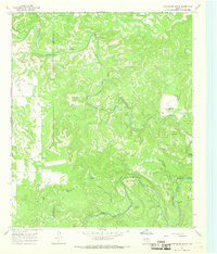
1966 Map of Hoover Mountain
USGS Topo · Published 1968About this map
The Clear Fork Brazos River winds through the borderlands of Haskell and Throckmorton Counties, carving a complex landscape of bends and ridges such as Shinnery Bend and Cedar Ridge. This mid-century survey captures a ranching and petroleum landscape defined by isolated landmarks like the Sloan Ranch and Hoover Mountain. Water management is central to the area's utility, evidenced by numerous named stock tanks including Wolf Creek Tank, Buffalo Tank, and Cottonwood Tank.
Find a feature on this map
29 named features on this map. Tap any name to fly to it.
Don’t see what you’re looking for? This feature index may not catch every label — zoom into the map to look around manually.
Map Details
Editions of this 1966 Hoover Mountain Map
This is the sole edition of this map. No revisions or reprints were ever made.
Other maps of this area

1891 · Anson
USGS Topo · 1:125,000

1892 · Albany
USGS Topo · 1:125,000

1893 · Albany
USGS Topo · 1:125,000

1893 · Anson
USGS Topo · 1:125,000

1954 · Abilene
USGS Topo · 1:250,000

1954 · Wichita Falls
USGS Topo · 1:250,000

1958 · Wichita Falls
USGS Topo · 1:250,000

1958 · Abilene
USGS Topo · 1:250,000

1965 · Lueders NE
USGS Topo · 1:24,000

1965 · Collins Creek
USGS Topo · 1:24,000