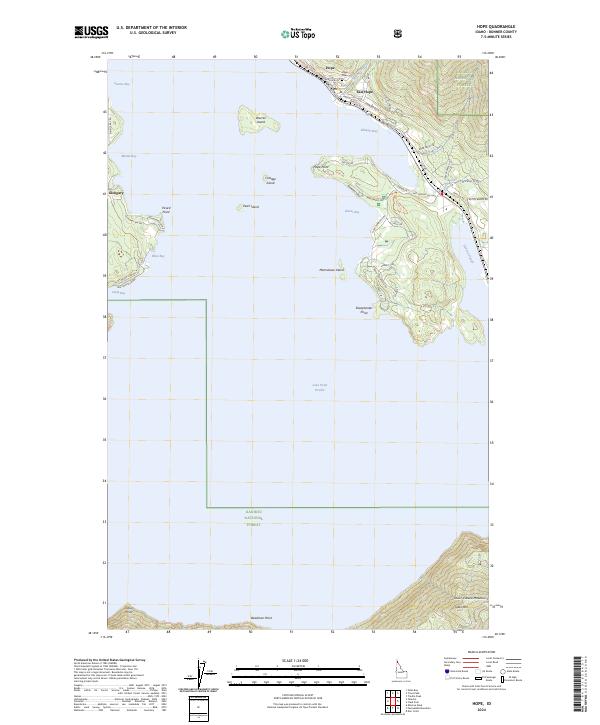
2024 Map of Hope
USGS Topo · Published 2024About this map
Lake Pend Oreille dominates this northern Idaho landscape, where the settlements of Hope and East Hope cling to the steep northern shoreline. The map reveals a complex waterfront geography defined by deep inlets like Ellisport Bay and Owens Bay, alongside numerous landforms such as Hope Point and Sheepherder Point. Inland from the water, the terrain rises sharply into the Kaniksu National Forest and the northern reaches of the Coeur d'Alene Mountains, where Jakes Mtn stands as a prominent peak.
Find a feature on this map
64 named features on this map. Tap any name to fly to it.
Don’t see what you’re looking for? This feature index may not catch every label — zoom into the map to look around manually.
Map Details
Editions of this 2024 Hope Map
This is the sole edition of this map. No revisions or reprints were ever made.
Other maps of this area

1911 · Priest Lake
USGS Topo · 1:250,000

1913 · Priest Lake
USGS Topo · 1:250,000

1949 · Packsaddle Mtn
USGS Topo · 1:62,500

1951 · Packsaddle Mtn
USGS Topo · 1:62,500

1951 · Clark Fork
USGS Topo · 1:62,500

1951 · Mt Pend Oreille
USGS Topo · 1:62,500

1951 · Elmira
USGS Topo · 1:62,500

1958 · Sandpoint
USGS Topo · 1:250,000

1963 · Sandpoint
USGS Topo · 1:250,000
1984 · Sandpoint
USGS Topo · 1:100,000