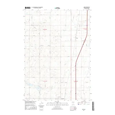
2016 Map of Hope
USGS Topo · Published 2016About this map
Hope and Ellendale anchor this agricultural landscape in Steele County, reflecting the enduring township-and-range grid system that defines Southern Minnesota. The map reveals a deeply rooted rural community, highlighted by several local burying grounds such as Zion Lutheran Cem, the Danish Cem, and Berlin Cem, which serve as vital markers for genealogical research in the area. Water features provide the primary natural variation to the surveyed fields, with the Straight River flowing through the northern section and the Little Le Sueur River crossing the northwest corner. To the southwest, Beaver Lake and Lonergan Lake offer significant landmarks within the prairie-pothole terrain. The extensive road network, including Co Hwy 14 and Co Hwy 30, illustrates the modern connectivity between these small settlements and the surrounding farms.
Find a feature on this map
45 named features on this map. Tap any name to fly to it.
Don’t see what you’re looking for? This feature index may not catch every label — zoom into the map to look around manually.
Map Details
Editions of this 2016 Hope Map
This is the sole edition of this map. No revisions or reprints were ever made.
Other maps of this area

1953 · Saint Paul
USGS Topo · 1:250,000

1954 · Mason City
USGS Topo · 1:250,000

1957 · Mason City
USGS Topo · 1:250,000

1958 · Mason City
USGS Topo · 1:250,000

1959 · Saint Paul
USGS Topo · 1:250,000

1962 · Owatonna
USGS Topo · 1:24,000

1962 · Saco
USGS Topo · 1:24,000

1962 · Meriden
USGS Topo · 1:24,000

1967 · Steele Center
USGS Topo · 1:24,000

1967 · Hollandale
USGS Topo · 1:24,000