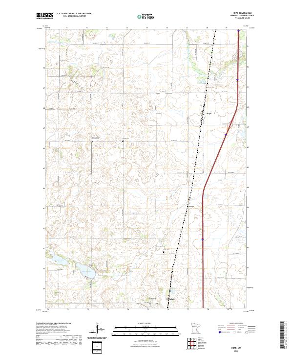
2022 Map of Hope
USGS Topo · Published 2022About this map
Hope and Ellendale anchor this portion of Steele County, revealing a landscape defined by the precision of the Public Land Survey System. The region is dotted with significant genealogical sites, including the Zion Lutheran Church Cem, the Danish Cem, and Berlin Cem, which serve as quiet markers of the area's immigrant heritage and early rural communities. The drainage of the Little Le Sueur River and the Straight River provides a natural contrast to the rigid grid of section roads like SW 68th St and Co Hwy 4. To the south, the presence of Lonergan Lake and Beaver Lake, connected by S Beaver Lake Rd, highlights the glacial geography of the Minnesota prairie. This survey captures the enduring agricultural character of the townships of T106N R21W and T105N R21W, where farmsteads are linked by a dense network of county highways and local roads.
Find a feature on this map
35 named features on this map. Tap any name to fly to it.
Don’t see what you’re looking for? This feature index may not catch every label — zoom into the map to look around manually.
Map Details
Editions of this 2022 Hope Map
This is the sole edition of this map. No revisions or reprints were ever made.
Other maps of this area

1953 · Saint Paul
USGS Topo · 1:250,000

1954 · Mason City
USGS Topo · 1:250,000

1957 · Mason City
USGS Topo · 1:250,000

1958 · Mason City
USGS Topo · 1:250,000

1959 · Saint Paul
USGS Topo · 1:250,000

1962 · Owatonna
USGS Topo · 1:24,000

1962 · Saco
USGS Topo · 1:24,000

1962 · Meriden
USGS Topo · 1:24,000

1967 · Steele Center
USGS Topo · 1:24,000

1967 · Hollandale
USGS Topo · 1:24,000