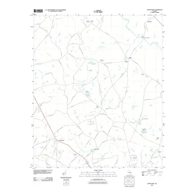
2011 Map of Hopeulikit
USGS Topo · Published 2011About this map
Hopeulikit sits at the junction of modern transit corridors in this Bulloch County landscape, where the rural character of southeastern Georgia is defined by a dense network of family cemeteries and small agricultural settlements. The area around Akins Mill and Blitch reflects a community structure rooted in local land ownership, evidenced by numerous namesake roads such as Agnes Akins Rd and Dannie Carter Rd. The geography is intricately tied to the waters of the Ogeechee River and its many tributaries, including Nevills Creek and Mill Creek. These water bodies are often managed via local infrastructure, as seen at the Marsh Pond Dam and Tillman Pond Dam. For genealogists, the map is particularly detailed, locating several burial grounds including Hendrix Cemetery, Temple Hill Cemetery, and Union Cemetery, which serve as permanent markers of the region's historic family lines.
Find a feature on this map
95 named features on this map. Tap any name to fly to it.
Don’t see what you’re looking for? This feature index may not catch every label — zoom into the map to look around manually.
Map Details
Editions of this 2011 Hopeulikit Map
This is the sole edition of this map. No revisions or reprints were ever made.
Other maps of this area

1918 · Oliver
USGS Topo · 1:62,500

1920 · Statesboro
USGS Topo · 1:62,500

1920 · Oliver
USGS Topo · 1:62,500

1921 · Brooklet
USGS Topo · 1:62,500

1921 · Rocky Ford
USGS Topo · 1:62,500

1943 · Brooklet
USGS Topo · 1:62,500

1943 · Rocky Ford
USGS Topo · 1:62,500

1943 · Millen
USGS Topo · 1:125,000

1943 · Statesboro
USGS Topo · 1:62,500

1943 · Oliver
USGS Topo · 1:62,500