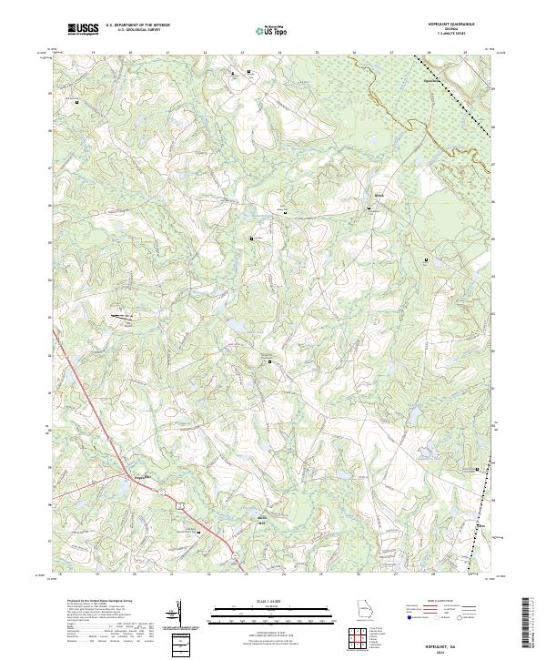
2024 Map of Hopeulikit
USGS Topo · Published 2024About this map
Hopeulikit sits at a major crossroads in Bulloch County, Georgia, serving as a focal point for a rural landscape defined by slow-moving water and long-established community landmarks. The Ogeechee River snakes across the northern reaches of the quadrangle, forming the boundary with Screven County and anchoring small settlements like Ogeechee. To the south, Akins Mill and the surrounding basin of Mill Creek point to the area’s historic reliance on water power and agriculture. Numerous family and community burial grounds, including the Donaldson Cem and Saint Marys Cem, are scattered throughout the region, offering a detailed record of local family names and church history. The presence of the HIA Airport near Bunks Creek introduces a modern infrastructure element to a terrain otherwise dominated by names reflecting the natural environment, such as Marsh Pond and Rattlesnake Creek.
Find a feature on this map
130 named features on this map. Tap any name to fly to it.
Don’t see what you’re looking for? This feature index may not catch every label — zoom into the map to look around manually.
Map Details
Editions of this 2024 Hopeulikit Map
This is the sole edition of this map. No revisions or reprints were ever made.
Other maps of this area

1918 · Oliver
USGS Topo · 1:62,500

1920 · Statesboro
USGS Topo · 1:62,500

1920 · Oliver
USGS Topo · 1:62,500

1921 · Brooklet
USGS Topo · 1:62,500

1921 · Rocky Ford
USGS Topo · 1:62,500

1943 · Brooklet
USGS Topo · 1:62,500

1943 · Rocky Ford
USGS Topo · 1:62,500

1943 · Millen
USGS Topo · 1:125,000

1943 · Statesboro
USGS Topo · 1:62,500

1943 · Oliver
USGS Topo · 1:62,500