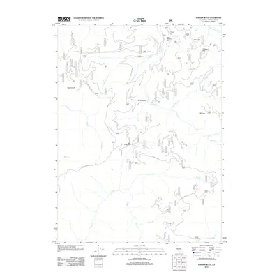
2012 Map of Hopkins Butte
USGS Topo · Published 2012About this map
Schnable Diggings stands as a point of historical industrial interest within this part of the Klamath Mountains, where the landscape is defined by its complex drainage systems and prominent ridges. The area is heavily marked by the tributaries of Red Cap Cr and Leary Cr, which carve through the high terrain between Black Mountain and Hopkins Butte. Transport through this vertical environment is largely restricted to forest routes and established paths such as the Mill Creek Trl and the Hopkins Butte Trl. The presence of Tenmile Spring and LePerron Peak Spring highlights the importance of reliable water sources in these higher elevations. For those tracing the history of land use in Humboldt County, the map reveals the relationship between geological features like Packsaddle Ridge and the historic resource extraction sites that once operated in these more isolated reaches of the Pacific Northwest.
Find a feature on this map
30 named features on this map. Tap any name to fly to it.
Don’t see what you’re looking for? This feature index may not catch every label — zoom into the map to look around manually.
Map Details
Editions of this 2012 Hopkins Butte Map
This is the sole edition of this map. No revisions or reprints were ever made.
Other maps of this area

1925 · Hoopa
USGS Topo · 1:125,000

1948 · Weed
USGS Topo · 1:250,000

1950 · Weed
USGS Topo · 1:250,000

1952 · Hoopa
USGS Topo · 1:62,500

1952 · Orleans
USGS Topo · 1:62,500

1955 · Salmon Mtn
USGS Topo · 1:62,500

1955 · Forks of Salmon
USGS Topo · 1:62,500

1958 · Weed
USGS Topo · 1:250,000

1963 · Weed
USGS Topo · 1:250,000

1974 · Orleans Mtn.
USGS Topo · 1:24,000