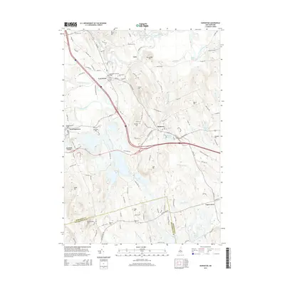
2015 Map of Hopkinton
USGS Topo · Published 2015About this map
The Contoocook River and its major tributaries, the Warner River and Blackwater River, converge in this central New Hampshire landscape, defining the layout of the historic villages. The topography is marked by several prominent heights, including Gould Hill, Putney Hill, and Rattlesnake Hill, which overlook the river valleys. The village of Contoocook is a focal point, featuring the notable Contoocook Covered Bridge, while West Hopkinton preserves the Rowell Covered Bridge to the west. Several small cemeteries, such as the Old Hop Cem and Blackwater Cem, are scattered across the quadrangle, indicating long-established settlement patterns. To the south, the terrain becomes more varied around Drew Lake and Irish Hill as the landscape transitions toward the boundary with Hillsborough County.
Find a feature on this map
123 named features on this map. Tap any name to fly to it.
Don’t see what you’re looking for? This feature index may not catch every label — zoom into the map to look around manually.
Map Details
Editions of this 2015 Hopkinton Map
This is the sole edition of this map. No revisions or reprints were ever made.
Other maps of this area

1926 · Hillsboro
USGS Topo · 1:62,500

1927 · Concord
USGS Topo · 1:62,500

1927 · Penacook
USGS Topo · 1:62,500

1928 · Mount Kearsarge
USGS Topo · 1:62,500

1929 · Hillsboro
USGS Topo · 1:62,500

1931 · Mount Kearsarge
USGS Topo · 1:62,500

1949 · Portland
USGS Topo · 1:250,000

1949 · Concord
USGS Topo · 1:62,500

1956 · Penacook
USGS Topo · 1:62,500

1956 · Mt. Kearsarge
USGS Topo · 1:62,500