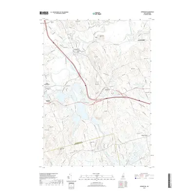
2018 Map of Hopkinton
USGS Topo · Published 2018About this map
The Contoocook River winds through the heart of this Merrimack County landscape, defining the character of several historic New Hampshire settlements. In Contoocook, the Contoocook Covered Bridge stands as a significant landmark near the Contoocook Cem, while to the west, the Rowell Covered Bridge spans the water near West Hopkinton. The terrain is marked by numerous family-named elevations such as Gould Hill and Putney Hill, punctuated by specialized ecological areas like the Smith Pond Bog and Stumpfield Marsh. The survey details an extensive network of local roads and cemeteries, including the Old Hop Cem and New Cem in Hopkinton, offering a clear view of the rural and village layouts as they existed in the late 2010s.
Find a feature on this map
126 named features on this map. Tap any name to fly to it.
Don’t see what you’re looking for? This feature index may not catch every label — zoom into the map to look around manually.
Map Details
Editions of this 2018 Hopkinton Map
This is the sole edition of this map. No revisions or reprints were ever made.
Other maps of this area

1926 · Hillsboro
USGS Topo · 1:62,500

1927 · Concord
USGS Topo · 1:62,500

1927 · Penacook
USGS Topo · 1:62,500

1928 · Mount Kearsarge
USGS Topo · 1:62,500

1929 · Hillsboro
USGS Topo · 1:62,500

1931 · Mount Kearsarge
USGS Topo · 1:62,500

1949 · Portland
USGS Topo · 1:250,000

1949 · Concord
USGS Topo · 1:62,500

1956 · Penacook
USGS Topo · 1:62,500

1956 · Mt. Kearsarge
USGS Topo · 1:62,500