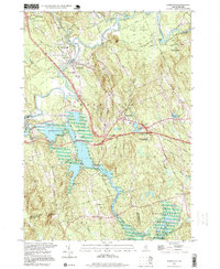
1995 Map of Hopkinton
USGS Topo · Published 1999About this map
The Contoocook River snakes through this central New Hampshire landscape, defining the character of Hopkinton and the village of Contoocook. By the late 20th century, the landscape reflected a complex layer of water management and recreation centered on the Hopkinton-Everett Reservoir and the Hopkinton Dam. These engineering works transformed the drainage of Elm Brook and Stumpfield Marsh, creating recreation areas that sit alongside older traces of settlement. Genealogists will find several family and local burial grounds, including Putney Cem and Blackwater Cem, while the industrial history of the valley is marked by the path of the Contoocook Valley Railroad and the Boston and Maine Railroad. From the heights of Gould Hill and Putney Hill down to the banks of the Blackwater River, the map preserves the transition from traditional mill-town geography to a modern era of forest conservation in the Mast Yard State Forest.
Find a feature on this map
64 named features on this map. Tap any name to fly to it.
Don’t see what you’re looking for? This feature index may not catch every label — zoom into the map to look around manually.
Map Details
Editions of this 1995 Hopkinton Map
This is the sole edition of this map. No revisions or reprints were ever made.
Other maps of this area

1926 · Hillsboro
USGS Topo · 1:62,500

1927 · Concord
USGS Topo · 1:62,500

1927 · Penacook
USGS Topo · 1:62,500

1928 · Mount Kearsarge
USGS Topo · 1:62,500

1929 · Hillsboro
USGS Topo · 1:62,500

1931 · Mount Kearsarge
USGS Topo · 1:62,500

1949 · Portland
USGS Topo · 1:250,000

1949 · Concord
USGS Topo · 1:62,500

1956 · Penacook
USGS Topo · 1:62,500

1956 · Mt. Kearsarge
USGS Topo · 1:62,500