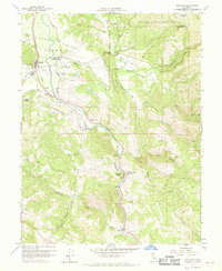
1960 Map of Hopland
USGS Topo · Published 1970About this map
Sanel Valley serves as the agricultural heart of this Mendocino County landscape, where the Russian River winds alongside the tracks of the Northwestern Pacific railroad. The distinction between the current settlement of Hopland and the site of Old Hopland reflects the shifting centers of commerce and transport during the valley's development. To the east, the McDowell Valley and the Hopland Indian Reservation occupy the higher terrain, marked by a network of seasonal watercourses like McDowell Creek and Coleman Creek.
Find a feature on this map
30 named features on this map. Tap any name to fly to it.
Don’t see what you’re looking for? This feature index may not catch every label — zoom into the map to look around manually.
Map Details
Editions of this 1960 Hopland Map
3 editions found
Other maps of this area

1920 · Ukiah
USGS Topo · 1:62,500

1921 · Kelseyville
USGS Topo · 1:62,500

1938 · Lakeport
USGS Topo · 1:62,500

1938 · Hopland
USGS Topo · 1:62,500

1943 · Kelseyville
USGS Topo · 1:62,500

1943 · Hopland
USGS Topo · 1:62,500

1944 · Ukiah
USGS Topo · 1:62,500

1944 · Hopland
USGS Topo · 1:62,500

1947 · Santa Rosa
USGS Topo · 1:250,000

1949 · Santa Rosa
USGS Topo · 1:250,000