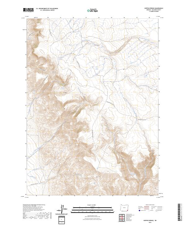
2024 Map of Hoppin Springs
USGS Topo · Published 2024About this map
The West Little Owyhee Wild and Scenic River meanders across this corner of Malheur County, defining a landscape of high-desert drainage and livestock-rearing infrastructure. The importance of water management in this arid reach is visible in features like the Larribeau Reservoir, the Nouque Ditch, and the numerous named springs scattered among the coulees. Named ranching roads like Nouque Ranch Rd and Frenchman Creek Rd provide the primary access through the canyon country, linking the uplands of The Basin with deep cuts like Lowry Canyon. For the researcher, the map documents a network of high-elevation water sources such as Andy Five Spring and Shearing Corral Spring, alongside more prominent landmarks like The Water Fall and the namesake Hoppin Springs.
Find a feature on this map
29 named features on this map. Tap any name to fly to it.
Don’t see what you’re looking for? This feature index may not catch every label — zoom into the map to look around manually.
Map Details
Editions of this 2024 Hoppin Springs Map
This is the sole edition of this map. No revisions or reprints were ever made.
Other maps of this area

1882 · Paradise
USGS Topo · 1:250,000

1893 · Paradise
USGS Topo · 1:250,000

1955 · McDermitt
USGS Topo · 1:250,000

1955 · Jordan Valley
USGS Topo · 1:250,000

1957 · Jordan Valley
USGS Topo · 1:250,000

1958 · Jordan Valley
USGS Topo · 1:250,000

1959 · McDermitt
USGS Topo · 1:250,000

1959 · McDermitt
USGS Topo · 1:62,500

1980 · Odell Mountain
USGS Topo · 1:24,000
1982 · Jackson Summit
USGS Topo · 1:24,000