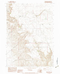
1982 Map of Hoppin Springs
USGS Topo · Published 1983About this map
The Fort McDermitt Indian Reservation occupies the central and southern portions of this landscape, where the high desert is carved by deep drainage systems. The presence of the Chino Homestead Ruin in the northeast suggests the difficult nature of permanent settlement in this arid environment, contrasted by a network of water sources like Juans Forty Springs and Wild Rose Spring that sustained early inhabitants and ranchers.
Find a feature on this map
27 named features on this map. Tap any name to fly to it.
Don’t see what you’re looking for? This feature index may not catch every label — zoom into the map to look around manually.
Map Details
Editions of this 1982 Hoppin Springs Map
This is the sole edition of this map. No revisions or reprints were ever made.
Other maps of this area

1882 · Paradise
USGS Topo · 1:250,000

1893 · Paradise
USGS Topo · 1:250,000

1955 · McDermitt
USGS Topo · 1:250,000

1955 · Jordan Valley
USGS Topo · 1:250,000

1957 · Jordan Valley
USGS Topo · 1:250,000

1958 · Jordan Valley
USGS Topo · 1:250,000

1959 · McDermitt
USGS Topo · 1:250,000

1959 · McDermitt
USGS Topo · 1:62,500

1980 · Odell Mountain
USGS Topo · 1:24,000
1982 · Jackson Summit
USGS Topo · 1:24,000