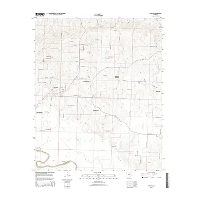
2014 Map of Horatio
USGS Topo · Published 2014About this map
Horatio serves as the central hub of this Sevier County landscape, where the confluence of local roads like Main St and Bruce St meet the corridor of Ar-41. The town and its outlying settlements, including Norwoodville, Walnut Springs, and Williamson, are situated amidst a network of small creeks and drainage patterns such as Mill Cr and Blue Cr. The presence of numerous small burial grounds, from Horatio Cem to the more remote Mt Ida Cem, suggests a long-settled rural community with deeply rooted family lineages. To the south, the terrain descends toward the Little River, which defines the boundary between Sevier and Little River counties. Features like Stallion Ford on the river and the Otter Slide terrain feature near Double K Lake indicate a landscape historically shaped by both its watercourses and its low-lying wetlands like Berks Slough.
Find a feature on this map
114 named features on this map. Tap any name to fly to it.
Don’t see what you’re looking for? This feature index may not catch every label — zoom into the map to look around manually.
Map Details
Editions of this 2014 Horatio Map
This is the sole edition of this map. No revisions or reprints were ever made.
Other maps of this area

1913 · De Queen
USGS Topo · 1:125,000

1950 · Mcalester
USGS Topo · 1:250,000

1950 · Falls Chapel
USGS Topo · 1:24,000

1950 · Winthrop
USGS Topo · 1:24,000

1951 · Winthrop
USGS Topo · 1:24,000

1951 · Falls Chapel
USGS Topo · 1:24,000

1951 · Arkinda
USGS Topo · 1:24,000

1951 · Cerrogordo
USGS Topo · 1:24,000

1951 · Horatio
USGS Topo · 1:24,000

1951 · Lockesburg
USGS Topo · 1:24,000