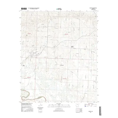
2017 Map of Horatio
USGS Topo · Published 2017About this map
Horatio serves as the primary hub of this Sevier County landscape, where the street grid converges around Main St and Bruce St. The surrounding countryside is defined by a dense network of cemeteries, including the Horatio Cem just south of town, and more remote sites like Norwoodville Cem and Millwee Cem to the east. The terrain transitions from the developed center into a complex hydrological system to the south and west. Here, the Little River and Little River Co border define the edge of a landscape filled with wetlands and sluggish waterways such as Burk Slough, Berks Slough, and Clear Cr. Small clusters of activity persist at Neal Springs and Williamson, while the northeastern corner rises toward Beacon Hill Rd, marking a shift away from the riverine lowlands toward more elevated woodland roads.
Find a feature on this map
103 named features on this map. Tap any name to fly to it.
Don’t see what you’re looking for? This feature index may not catch every label — zoom into the map to look around manually.
Map Details
Editions of this 2017 Horatio Map
This is the sole edition of this map. No revisions or reprints were ever made.
Other maps of this area

1913 · De Queen
USGS Topo · 1:125,000

1950 · Mcalester
USGS Topo · 1:250,000

1950 · Falls Chapel
USGS Topo · 1:24,000

1950 · Winthrop
USGS Topo · 1:24,000

1951 · Winthrop
USGS Topo · 1:24,000

1951 · Falls Chapel
USGS Topo · 1:24,000

1951 · Arkinda
USGS Topo · 1:24,000

1951 · Cerrogordo
USGS Topo · 1:24,000

1951 · Horatio
USGS Topo · 1:24,000

1951 · Lockesburg
USGS Topo · 1:24,000