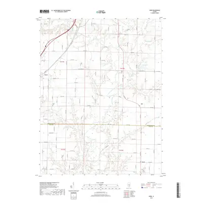
2018 Map of Hord
USGS Topo · Published 2018About this map
The Little Wabash River meanders across this landscape, defining the boundary between north and south as it flows through the heart of the region. This 2018 survey captures a rural stretch of the Illinois prairie where the small settlements of Mason, Hill, and Hord serve as local anchors. The map reveals a dense network of country roads following the section lines of the Public Land Survey System, interspersed with numerous small family and community burial grounds including Hull Cem, Leith Cem, and Fender Cem. The drainage patterns are intricate, with Salt Cr, Bishop Cr, and Fuller Cr carving out the terrain before joining the larger river system. North of Hill, Lake Walter Scott provides a significant water feature amidst the agricultural fields. The intersection of Us Rte 45 and the county line between Effingham and Clay counties highlights the administrative and transport geometry that has shaped local development for generations.
Find a feature on this map
69 named features on this map. Tap any name to fly to it.
Don’t see what you’re looking for? This feature index may not catch every label — zoom into the map to look around manually.
Map Details
Editions of this 2018 Hord Map
This is the sole edition of this map. No revisions or reprints were ever made.
Other maps of this area

1950 · Effingham
USGS Topo · 1:62,500

1951 · Effingham
USGS Topo · 1:62,500

1953 · Teutopolis
USGS Topo · 1:62,500

1953 · Sailor Springs
USGS Topo · 1:62,500

1956 · Edgewood
USGS Topo · 1:62,500

1958 · Decatur
USGS Topo · 1:250,000

1958 · Belleville
USGS Topo · 1:250,000

1961 · Decatur
USGS Topo · 1:250,000

1962 · Belleville
USGS Topo · 1:250,000
1985 · Hord
USGS Topo · 1:24,000