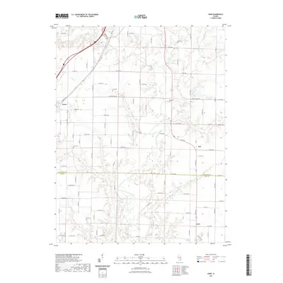
2021 Map of Hord
USGS Topo · Published 2021About this map
The Little Wabash River meanders through this portion of south-central Illinois, defining a landscape marked by small rural settlements and a dense network of country roads. The village of Mason sits in the northwest corner, while the smaller communities of Hill and Hord anchor the eastern and southern reaches of the sheet. The terrain is largely agricultural, punctuated by several historic burial grounds including Wright Cem, Fender Cem, and Hull Cem, which provide essential touchstones for genealogical research in the area. Water features such as Lake Walter Scott and several creeks, including Bishop Cr and Fuller Cr, drain the undulating fields. The map captures the interface between Effingham County and Clay County, showing how the local road systems and land divisions cross the county line south of Hill.
Find a feature on this map
55 named features on this map. Tap any name to fly to it.
Don’t see what you’re looking for? This feature index may not catch every label — zoom into the map to look around manually.
Map Details
Editions of this 2021 Hord Map
This is the sole edition of this map. No revisions or reprints were ever made.
Other maps of this area

1950 · Effingham
USGS Topo · 1:62,500

1951 · Effingham
USGS Topo · 1:62,500

1953 · Teutopolis
USGS Topo · 1:62,500

1953 · Sailor Springs
USGS Topo · 1:62,500

1956 · Edgewood
USGS Topo · 1:62,500

1958 · Decatur
USGS Topo · 1:250,000

1958 · Belleville
USGS Topo · 1:250,000

1961 · Decatur
USGS Topo · 1:250,000

1962 · Belleville
USGS Topo · 1:250,000
1985 · Hord
USGS Topo · 1:24,000