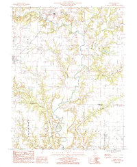
1985 Map of Hord
USGS Topo · Published 1985About this map
The Little Wabash River meanders through the heart of the Effingham and Clay county line, creating a complex network of drainage basins including Salt Creek, Bishop Creek, and Coon Creek. This mid-1980s provisional study captures the rural character of southeastern Illinois, where small settlements like Mason and Hord serve as local anchors. The landscape is defined by its transition from the upland prairies of Mason and Union townships to the wooded, winding bottomlands of the river valley. Genealogists will find particular value in the location of Sublett Cem and the small residential clusters at Hill and Fulfer, which provide a clear record of family landholdings and settlement patterns before modern consolidation. The map also documents local infrastructure of the era, such as a prominent Radio Tower and the jurisdictional boundaries of Larkinsburg and Blair townships.
Find a feature on this map
21 named features on this map. Tap any name to fly to it.
Don’t see what you’re looking for? This feature index may not catch every label — zoom into the map to look around manually.
Map Details
Editions of this 1985 Hord Map
This is the sole edition of this map. No revisions or reprints were ever made.
Other maps of this area

1950 · Effingham
USGS Topo · 1:62,500

1951 · Effingham
USGS Topo · 1:62,500

1953 · Teutopolis
USGS Topo · 1:62,500

1953 · Sailor Springs
USGS Topo · 1:62,500

1956 · Edgewood
USGS Topo · 1:62,500

1958 · Decatur
USGS Topo · 1:250,000

1958 · Belleville
USGS Topo · 1:250,000

1961 · Decatur
USGS Topo · 1:250,000

1962 · Belleville
USGS Topo · 1:250,000
1985 · Dieterich
USGS Topo · 1:24,000