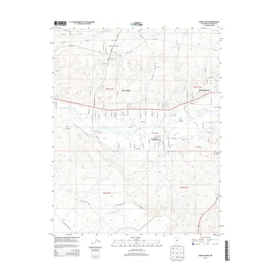
2013 Map of Horn Canyon
USGS Topo · Published 2013About this map
The San Juan River corridor anchors this modern survey, revealing a landscape defined by the management of water in an arid environment. In the eastern portion of the map, Bloomfield serves as a primary hub of activity, while the smaller residential clusters of Lee Acres and West Hammond are situated further west along the river valley. The intricate irrigation network is clearly visible, including the Hammond Main Canal and the Kutz Canyon Ditch, which divert water from the river to support local agriculture and development. Away from the valley floor, the terrain transitions into the starker geomorphology of Horn Canyon and Kutz Canyon, where the natural drainage patterns contrast with the rectilinear grid of modern road designations like Co Road 390 and Road 5030.
Find a feature on this map
99 named features on this map. Tap any name to fly to it.
Don’t see what you’re looking for? This feature index may not catch every label — zoom into the map to look around manually.
Map Details
Editions of this 2013 Horn Canyon Map
This is the sole edition of this map. No revisions or reprints were ever made.
Other maps of this area

1889 · Largo
USGS Topo · 1:250,000

1889 · Chaco
USGS Topo · 1:250,000

1892 · Chaco
USGS Topo · 1:250,000

1895 · Largo
USGS Topo · 1:250,000

1954 · Shiprock
USGS Topo · 1:250,000

1954 · Aztec
USGS Topo · 1:250,000

1958 · Shiprock
USGS Topo · 1:250,000

1958 · Aztec
USGS Topo · 1:250,000

1959 · Shiprock
USGS Topo · 1:250,000

1959 · Aztec
USGS Topo · 1:62,500