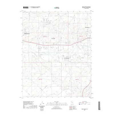
2020 Map of Horn Canyon
USGS Topo · Published 2020About this map
The San Juan River valley serves as the central corridor for this 2020 topographic landscape, anchoring a string of residential developments between major regional hubs. The transition from the eastern edge of Farmington through Lee Acres to Bloomfield illustrates the modern suburbanization of San Juan County's riverfront property. While the river bottom supports these denser settlements like West Hammond, the surrounding terrain quickly shifts to the arid, dissected plateaus of the Four Corners region. To the south and east, the deeply carved drainage of Horn Canyon and Kutz Canyon define the topography, while Gallegos Spring provides a rare water point in the higher desert land. The extensive grid of local roads, such as Crouch Mesa Rd, reflects the ongoing parceling of mesa land for housing and commercial use outside the established city limits.
Find a feature on this map
99 named features on this map. Tap any name to fly to it.
Don’t see what you’re looking for? This feature index may not catch every label — zoom into the map to look around manually.
Map Details
Editions of this 2020 Horn Canyon Map
This is the sole edition of this map. No revisions or reprints were ever made.
Other maps of this area

1889 · Largo
USGS Topo · 1:250,000

1889 · Chaco
USGS Topo · 1:250,000

1892 · Chaco
USGS Topo · 1:250,000

1895 · Largo
USGS Topo · 1:250,000

1954 · Shiprock
USGS Topo · 1:250,000

1954 · Aztec
USGS Topo · 1:250,000

1958 · Shiprock
USGS Topo · 1:250,000

1958 · Aztec
USGS Topo · 1:250,000

1959 · Shiprock
USGS Topo · 1:250,000

1959 · Aztec
USGS Topo · 1:62,500