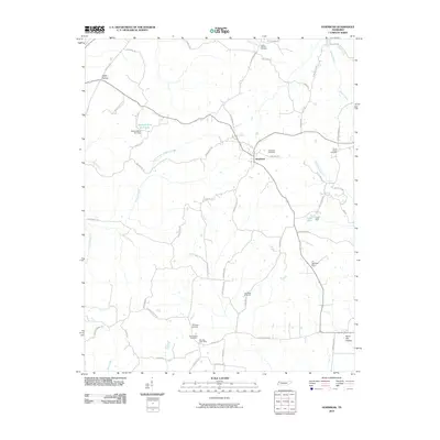
2010 Map of Hornbeak
USGS Topo · Published 2010About this map
The town of Hornbeak serves as the central hub of this Obion County landscape, situated where the drainage of North Branch Pawpaw Creek meets the local road network. The map reveals a rural community deeply rooted in its landscape, evidenced by the numerous burial grounds marking family and congregational histories, such as Thompson Cemetery, New Chapel Cemetery, and Oak Ridge Cemetery. Further south, the Elbridge Post Office serves as a vital point of reference for the surrounding area.
Find a feature on this map
63 named features on this map. Tap any name to fly to it.
Don’t see what you’re looking for? This feature index may not catch every label — zoom into the map to look around manually.
Map Details
Editions of this 2010 Hornbeak Map
This is the sole edition of this map. No revisions or reprints were ever made.
Other maps of this area

1925 · Reelfoot Lake
USGS Topo · 1:62,500

1939 · Reelfoot Lake
USGS Topo · 1:62,500

1939 · Dyersburg
USGS Topo · 1:62,500

1950 · Obion
USGS Topo · 1:24,000

1951 · Obion
USGS Topo · 1:24,000

1952 · Lane
USGS Topo · 1:24,000

1952 · Miston
USGS Topo · 1:24,000

1956 · Reelfoot Lake
USGS Topo · 1:62,500

1956 · Dyersburg
USGS Topo · 1:250,000
1961 · Dyersburg
USGS Topo · 1:62,500