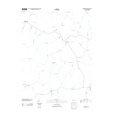
2013 Map of Hornbeak
USGS Topo · Published 2013About this map
The settlement of Hornbeak serves as the central hub of this Obion County landscape, situated where several regional roads converge. The area is defined by a network of small communities including Jacksonville, Elbridge, and Minnick, reflecting a rural settlement pattern deeply connected to the local topography. Water features such as Indian Cr and Pawpaw Cr drain the terrain, while landmarks like Glady Hollow Lake and Luker Lake punctuate the agricultural land. Evidence of earlier industrial or communal activity can be found in place names like Burnt Mill Hollow and Antioch Church Rd, which suggest the historic locations of essential local services. To the northwest, the land dips toward Reading House Slough, marking a transition in the hydrology of the Tennessee countryside. The dense web of named secondary roads, from Clover Creek Rd to Ira Barker Rd, provides a clear view of the established property lines and family routes that have shaped this portion of the state.
Find a feature on this map
72 named features on this map. Tap any name to fly to it.
Don’t see what you’re looking for? This feature index may not catch every label — zoom into the map to look around manually.
Map Details
Editions of this 2013 Hornbeak Map
This is the sole edition of this map. No revisions or reprints were ever made.
Other maps of this area

1925 · Reelfoot Lake
USGS Topo · 1:62,500

1939 · Reelfoot Lake
USGS Topo · 1:62,500

1939 · Dyersburg
USGS Topo · 1:62,500

1950 · Obion
USGS Topo · 1:24,000

1951 · Obion
USGS Topo · 1:24,000

1952 · Lane
USGS Topo · 1:24,000

1952 · Miston
USGS Topo · 1:24,000

1956 · Reelfoot Lake
USGS Topo · 1:62,500

1956 · Dyersburg
USGS Topo · 1:250,000
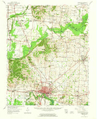
1961 · Dyersburg
USGS Topo · 1:62,500