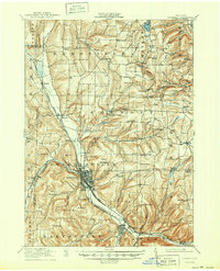
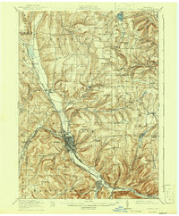
1918 Map of Hornell
USGS Topo · Published 1950About this map
Hornell serves as the industrial and transportation hub of the western Steuben County region during this First World War era survey. The city is a convergence point for several major rail lines, including the Erie R R, the Pittsburgh Shawmut and Northern, and the specialized Canisteo Electric line. These corridors follow the natural valleys carved by the Canisteo River and Canaseraga Creek, while the surrounding uplands of Cream Hill and Brown Hill remain distinctly rural.
Find a feature on this map
106 named features on this map. Tap any name to fly to it.
Don’t see what you’re looking for? This feature index may not catch every label — zoom into the map to look around manually.
Map Details
Editions of this 1918 Hornell Map
6 editions found
Other maps of this area

1900 · Naples
USGS Topo · 1:62,500

1902 · Wayland
USGS Topo · 1:62,500

1903 · Naples
USGS Topo · 1:62,500

1904 · Wayland
USGS Topo · 1:62,500

1905 · Nunda
USGS Topo · 1:62,500

1910 · Bath
USGS Topo · 1:62,500

1913 · Naples
USGS Topo · 1:62,500

1915 · Hornell
USGS Topo · 1:62,500

1916 · Canaseraga
USGS Topo · 1:62,500

1918 · Hornell
USGS Topo · 1:62,500