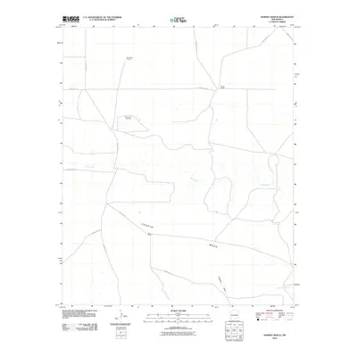
2010 Map of Horney Ranch
USGS Topo · Published 2010About this map
Horney Ranch and Field Ranch anchor this landscape in De Baca County, illustrating the sparse settlement patterns of central New Mexico. The geography is defined by the broad expanse of Conejo Mesa, where the land falls away into drainage systems like Gillespie Draw and the winding course of Yeso Creek. This 2010 survey emphasizes the vital role of water management in a semi-arid ranching environment, specifically identifying remote infrastructure such as the Yeso Camp Windmill and Black Lake Windmill. A network of local infrastructure, including County Rd-1-29 and County Rd-1-8, provides the primary connective tissue between these isolated homesteads and the seasonal waterways like Little Conejo Creek.
Find a feature on this map
16 named features on this map. Tap any name to fly to it.
Don’t see what you’re looking for? This feature index may not catch every label — zoom into the map to look around manually.
Map Details
Editions of this 2010 Horney Ranch Map
This is the sole edition of this map. No revisions or reprints were ever made.
Other maps of this area

1954 · Fort Sumner
USGS Topo · 1:250,000

1958 · Fort Sumner
USGS Topo · 1:250,000

1966 · West Camp
USGS Topo · 1:24,000

1966 · El Morro Mesa
USGS Topo · 1:24,000

1966 · Ricardo
USGS Topo · 1:24,000

1966 · Horney Ranch
USGS Topo · 1:24,000

1966 · Yeso
USGS Topo · 1:24,000

1966 · Yeso NW
USGS Topo · 1:24,000

1967 · Dunlap NE
USGS Topo · 1:24,000

1967 · Conejo Creek West
USGS Topo · 1:24,000