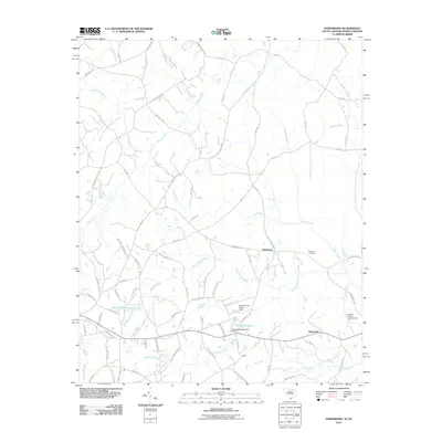
2011 Map of Hornsboro
USGS Topo · Published 2011About this map
Hornsboro serves as a quiet geographic center for this region on the border of South Carolina and North Carolina in the early 21st century. The landscape is defined by its intricate drainage patterns, with Thompson Creek and Brown Creek winding through the terrain. Numerous small impoundments like Hutsey Millpond and Rock Quarry Pond suggest a history of localized water management and resource extraction.
Find a feature on this map
82 named features on this map. Tap any name to fly to it.
Don’t see what you’re looking for? This feature index may not catch every label — zoom into the map to look around manually.
Map Details
Editions of this 2011 Hornsboro Map
This is the sole edition of this map. No revisions or reprints were ever made.
Other maps of this area

1941 · Spartanburg
USGS Topo · 1:250,000

1953 · Spartanburg
USGS Topo · 1:250,000

1960 · Spartanburg
USGS Topo · 1:250,000

1963 · Spartanburg
USGS Topo · 1:250,000

1964 · Spartanburg
USGS Topo · 1:250,000

1968 · Ruby
USGS Topo · 1:24,000

1968 · Jefferson
USGS Topo · 1:24,000

1968 · Jefferson NE
USGS Topo · 1:24,000

1970 · Marshville
USGS Topo · 1:24,000
1970 · Wingate
USGS Topo · 1:24,000