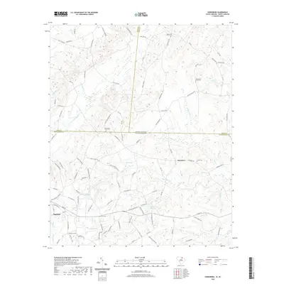
2020 Map of Hornsboro
USGS Topo · Published 2020About this map
Hornsboro sits at the intersection of rural roads just south of the state line, anchoring a landscape where the coastal plain meets the Piedmont. This region, documented in recent years, reveals a dense network of family-named roads and watercourses that speak to generations of settlement. To the southwest, the town of Pageland appears as the primary population center, while the surrounding countryside is dotted with spiritual and communal landmarks like Mount Moriah Church and Antioch Cem. The terrain is defined by a complex drainage system including the winding Thompson Cr and Stone House Cr, which feed into local landmarks such as Hutsey Millpond. This map provides a clear view of how modern boundaries, including the border between Anson County, North Carolina, and Chesterfield County, South Carolina, overlay an older pattern of agricultural life and small-town commerce.
Find a feature on this map
104 named features on this map. Tap any name to fly to it.
Don’t see what you’re looking for? This feature index may not catch every label — zoom into the map to look around manually.
Map Details
Editions of this 2020 Hornsboro Map
This is the sole edition of this map. No revisions or reprints were ever made.
Other maps of this area

1941 · Spartanburg
USGS Topo · 1:250,000

1953 · Spartanburg
USGS Topo · 1:250,000

1960 · Spartanburg
USGS Topo · 1:250,000

1963 · Spartanburg
USGS Topo · 1:250,000

1964 · Spartanburg
USGS Topo · 1:250,000

1968 · Ruby
USGS Topo · 1:24,000

1968 · Jefferson
USGS Topo · 1:24,000

1968 · Jefferson NE
USGS Topo · 1:24,000

1970 · Marshville
USGS Topo · 1:24,000
1970 · Wingate
USGS Topo · 1:24,000