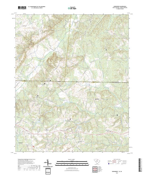
2024 Map of Hornsboro
USGS Topo · Published 2024About this map
Hornsboro and the outskirts of Pageland anchor this survey of the borderlands between Chesterfield County, South Carolina, and Anson County, North Carolina. The landscape is defined by the headwaters and drainages of Thompson Creek and Brown Creek, where the local economy and social life are reflected in numerous rural cemeteries and congregational sites. Genealogists will find a high density of burial grounds, including the Mount Moriah Church Graveyard, Salem Church Graveyard, and the Oro United Methodist Church Cem. The presence of Hutsey Millpond suggests the area's historical reliance on water-powered industry, while Rock Quarry Pond indicates the geographic utility of the local terrain. A complex network of secondary roads, such as Zion Church Rd and White Store Rd, connects these dispersed settlements and agrarian landmarks across the state line.
Find a feature on this map
120 named features on this map. Tap any name to fly to it.
Don’t see what you’re looking for? This feature index may not catch every label — zoom into the map to look around manually.
Map Details
Editions of this 2024 Hornsboro Map
This is the sole edition of this map. No revisions or reprints were ever made.
Other maps of this area

1941 · Spartanburg
USGS Topo · 1:250,000

1953 · Spartanburg
USGS Topo · 1:250,000

1960 · Spartanburg
USGS Topo · 1:250,000

1963 · Spartanburg
USGS Topo · 1:250,000

1964 · Spartanburg
USGS Topo · 1:250,000

1968 · Ruby
USGS Topo · 1:24,000

1968 · Jefferson
USGS Topo · 1:24,000

1968 · Jefferson NE
USGS Topo · 1:24,000

1970 · Marshville
USGS Topo · 1:24,000
1970 · Wingate
USGS Topo · 1:24,000