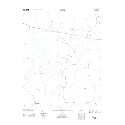
2013 Map of Hornsby
USGS Topo · Published 2013About this map
The Hatchie River and its intricate network of tributaries define the landscape of Hardeman County in this 2013 survey. The river's winding path creates the broad floodplain known as The Big Bottom, a signature geographical feature that dominates the western portion of the map. Small settlements like Hornsby and Serles are connected by a rural road network that reflects long-standing community landmarks, such as Gooch Store Rd, Brints Chapel Ln, and Powell Chapel Rd.
Find a feature on this map
69 named features on this map. Tap any name to fly to it.
Don’t see what you’re looking for? This feature index may not catch every label — zoom into the map to look around manually.
Map Details
Editions of this 2013 Hornsby Map
This is the sole edition of this map. No revisions or reprints were ever made.
Other maps of this area

1950 · Pocahontas
USGS Topo · 1:24,000

1950 · Hebron
USGS Topo · 1:24,000

1950 · Hornsby
USGS Topo · 1:24,000

1950 · Middleton
USGS Topo · 1:24,000

1951 · Middleton
USGS Topo · 1:24,000

1951 · Hebron
USGS Topo · 1:24,000

1951 · Hornsby
USGS Topo · 1:24,000

1951 · Chewalla
USGS Topo · 1:24,000

1951 · Rose Creek
USGS Topo · 1:24,000

1952 · Pocahontas
USGS Topo · 1:24,000