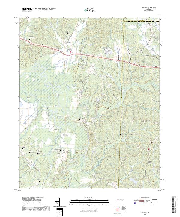
2022 Map of Hornsby
USGS Topo · Published 2022About this map
Hornsby serves as a central hub on this West Tennessee landscape, situated north of the expansive wetlands known as The Big Bottom. The terrain is defined by the winding course of the Hatchie River, which creates a complex network of waterways including Porters Creek and Little Hatchie Creek. This 2022 survey reveals a landscape deeply rooted in family and community history, evidenced by the numerous small burial grounds and churches that dot the countryside between Serles and the county line.
Find a feature on this map
89 named features on this map. Tap any name to fly to it.
Don’t see what you’re looking for? This feature index may not catch every label — zoom into the map to look around manually.
Map Details
Editions of this 2022 Hornsby Map
This is the sole edition of this map. No revisions or reprints were ever made.
Other maps of this area

1950 · Pocahontas
USGS Topo · 1:24,000

1950 · Hebron
USGS Topo · 1:24,000

1950 · Hornsby
USGS Topo · 1:24,000

1950 · Middleton
USGS Topo · 1:24,000

1951 · Middleton
USGS Topo · 1:24,000

1951 · Hebron
USGS Topo · 1:24,000

1951 · Hornsby
USGS Topo · 1:24,000

1951 · Chewalla
USGS Topo · 1:24,000

1951 · Rose Creek
USGS Topo · 1:24,000

1952 · Pocahontas
USGS Topo · 1:24,000