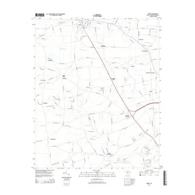
2014 Map of Horry
USGS Topo · Published 2014About this map
Aynor anchors the northern reaches of this coastal plain landscape, where the town’s grid of streets like Pine St and Hickory St meets the rural agricultural corridors of Horry County. The terrain is defined by an extensive network of blackwater drainages, most notably the wide reaches of Chinners Swamp, Palmetto Swamp, and Brown Swamp. These wetlands dictate the settlement pattern, with historic crossroads and small communities such as Jones Crossroads, Cool Spring, and Lundy Crossroads situated on the higher ground between creek branches. The map reveals the persistence of traditional land names and family-associated landmarks, including Dog Bluff and Knotty Branch, reflecting a deep-rooted local geography. A series of historic routes, such as Old Tram Rd, hint at the area's historical timber or agricultural transport legacy that helped shape these communities.
Find a feature on this map
103 named features on this map. Tap any name to fly to it.
Don’t see what you’re looking for? This feature index may not catch every label — zoom into the map to look around manually.
Map Details
Editions of this 2014 Horry Map
This is the sole edition of this map. No revisions or reprints were ever made.
Other maps of this area

1943 · Dongola
USGS Topo · 1:24,000

1943 · Adrian
USGS Topo · 1:24,000

1943 · Horry
USGS Topo · 1:24,000

1943 · Conway
USGS Topo · 1:24,000

1944 · Adrian
USGS Topo · 1:31,680

1946 · Johnsonville
USGS Topo · 1:62,500

1947 · Centenary
USGS Topo · 1:24,000

1948 · Galivants Ferry
USGS Topo · 1:24,000

1948 · Bayboro
USGS Topo · 1:24,000

1949 · Bayboro
USGS Topo · 1:24,000