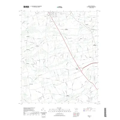
2020 Map of Horry
USGS Topo · Published 2020About this map
Aynor serves as the primary hub in this corner of Horry County, where a network of numbered avenues meets the larger regional thoroughfares. The landscape is defined by its low-lying hydrology, dominated by the expansive Little Pee Dee Swamp to the west and the wandering reaches of Palmetto Swamp and Chinners Swamp. These wetlands dictate the layout of rural crossroads like Jones Crossroads and Salem Crossroads, which appear as distinct focal points for the surrounding agricultural and forest lands. Along the southern reaches, the community of Jordanville sits near the winding course of Knotty Br. The survey details a transition from the structured street grid of the town into the sprawling drainage basins of the South Carolina coastal plain, where family-named landmarks such as Smith Pond and Schoolhouse Br mark the enduring character of the local geography.
Find a feature on this map
165 named features on this map. Tap any name to fly to it.
Don’t see what you’re looking for? This feature index may not catch every label — zoom into the map to look around manually.
Map Details
Editions of this 2020 Horry Map
This is the sole edition of this map. No revisions or reprints were ever made.
Other maps of this area

1943 · Dongola
USGS Topo · 1:24,000

1943 · Adrian
USGS Topo · 1:24,000

1943 · Horry
USGS Topo · 1:24,000

1943 · Conway
USGS Topo · 1:24,000

1944 · Adrian
USGS Topo · 1:31,680

1946 · Johnsonville
USGS Topo · 1:62,500

1947 · Centenary
USGS Topo · 1:24,000

1948 · Galivants Ferry
USGS Topo · 1:24,000

1948 · Bayboro
USGS Topo · 1:24,000

1949 · Bayboro
USGS Topo · 1:24,000