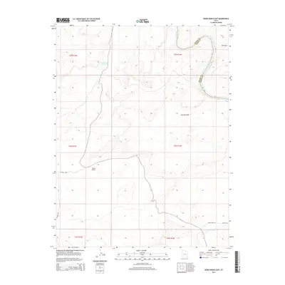
2014 Map of Horse Bench East
USGS Topo · Published 2014About this map
The Green River carves a significant boundary through this desert landscape at the border of Grand and Emery Counties. The terrain is defined by dramatic elevation shifts, particularly around the prominent Horse Bench plateau and the drainage systems of Salt Wash and Dry Lake Wash. Human presence is sparse and focused on water management and ranching, evidenced by the Horse Bench Reservoir and the Chaffin Ranch located near the confluence with the San Rafael River. Transportation is limited to rugged tracks like Co Road 1049 and Chaffin Ranch Rd, which follow the natural contours of the desert floor. This 2014 survey documents a region where the geography of seasonal washes and river bends continues to dictate the patterns of land use and access.
Find a feature on this map
17 named features on this map. Tap any name to fly to it.
Don’t see what you’re looking for? This feature index may not catch every label — zoom into the map to look around manually.
Map Details
Editions of this 2014 Horse Bench East Map
This is the sole edition of this map. No revisions or reprints were ever made.
Other maps of this area

1885 · San Rafael
USGS Topo · 1:250,000

1952 · Tidwell 4 NE
USGS Topo · 1:24,000

1954 · Tidwell 1 NE
USGS Topo · 1:24,000

1954 · Tidwell 1 SW
USGS Topo · 1:24,000

1954 · Tidwell 2 SE
USGS Topo · 1:24,000

1954 · Tidwell 2 NE
USGS Topo · 1:24,000

1954 · Tidwell 1 NW
USGS Topo · 1:24,000

1954 · Tidwell 1 SE
USGS Topo · 1:24,000

1954 · Tidwell Bottoms
USGS Topo · 1:62,500

1954 · Green River
USGS Topo · 1:62,500