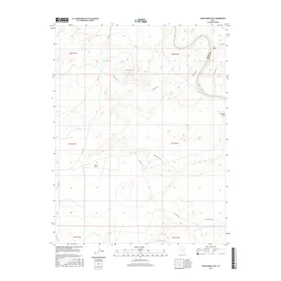
2017 Map of Horse Bench East
USGS Topo · Published 2017About this map
The Green River and the San Rafael River converge in this high-desert landscape on the border of Emery and Grand Counties. The dominant geographic feature is the elevated plateau of Horse Bench, which is marked by a series of primitive access routes and seasonal water improvements essential for high-country land use. Cattle ranching and water management history are evident through features like Horse Bench Reservoir and roads such as Irvin Ranch Rd and Chaffin Ranch Rd. This 2017 survey details the complex network of ephemeral drainages, including Salt Wash and Dry Lake Wash, that define the erosion patterns of the region. Local springs and tanks, such as Horse Bench Res E Spr, show the historical necessity of securing water sources in this arid stretch of eastern Utah.
Find a feature on this map
19 named features on this map. Tap any name to fly to it.
Don’t see what you’re looking for? This feature index may not catch every label — zoom into the map to look around manually.
Map Details
Editions of this 2017 Horse Bench East Map
This is the sole edition of this map. No revisions or reprints were ever made.
Other maps of this area

1885 · San Rafael
USGS Topo · 1:250,000

1952 · Tidwell 4 NE
USGS Topo · 1:24,000

1954 · Tidwell 1 NE
USGS Topo · 1:24,000

1954 · Tidwell 1 SW
USGS Topo · 1:24,000

1954 · Tidwell 2 SE
USGS Topo · 1:24,000

1954 · Tidwell 2 NE
USGS Topo · 1:24,000

1954 · Tidwell 1 NW
USGS Topo · 1:24,000

1954 · Tidwell 1 SE
USGS Topo · 1:24,000

1954 · Tidwell Bottoms
USGS Topo · 1:62,500

1954 · Green River
USGS Topo · 1:62,500