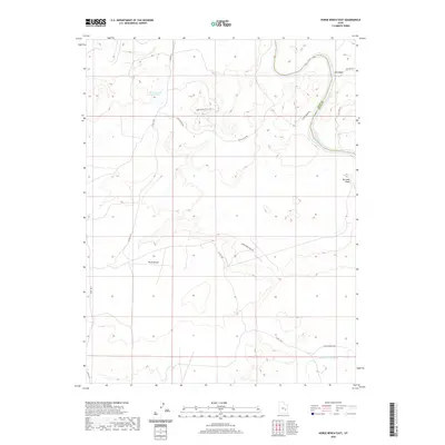
2020 Map of Horse Bench East
USGS Topo · Published 2020About this map
Green River and the Sun Rafael River dominate this arid landscape on the border of Grand and Emery counties. The terrain is characterized by broad plateaus and winding drainage systems, most notably the high ground of Horse Bench. While human settlement is sparse, the map documents a network of ranching roads and water management features essential for life in the high desert. Irvin Ranch Rd and Chaffin Ranch Rd provide access through the backcountry, connecting isolated points like the Horse Bench Reservoir. The intricate network of washes, including Salt Wash and Dry Lake Wash, illustrates the natural hydrological patterns that dictate movement and land use in this part of Utah. The proximity of the Emery Co Grand Co boundary highlights the administrative division of this vast, open range.
Find a feature on this map
15 named features on this map. Tap any name to fly to it.
Don’t see what you’re looking for? This feature index may not catch every label — zoom into the map to look around manually.
Map Details
Editions of this 2020 Horse Bench East Map
This is the sole edition of this map. No revisions or reprints were ever made.
Other maps of this area

1885 · San Rafael
USGS Topo · 1:250,000

1952 · Tidwell 4 NE
USGS Topo · 1:24,000

1954 · Tidwell 1 NE
USGS Topo · 1:24,000

1954 · Tidwell 1 SW
USGS Topo · 1:24,000

1954 · Tidwell 2 SE
USGS Topo · 1:24,000

1954 · Tidwell 2 NE
USGS Topo · 1:24,000

1954 · Tidwell 1 NW
USGS Topo · 1:24,000

1954 · Tidwell 1 SE
USGS Topo · 1:24,000

1954 · Tidwell Bottoms
USGS Topo · 1:62,500

1954 · Green River
USGS Topo · 1:62,500