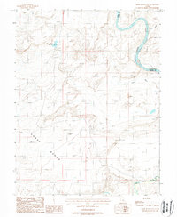
1988 Map of Horse Bench East
USGS Topo · Published 1988About this map
The Green River carves a deep, winding path through the desert landscape along the border of Emery and Grand Counties, defining the eastern edge of this late 1980s survey. To the south, the San Rafael River flows through the canyon bottom, highlighting the critical role of water in this arid environment. The map is dominated by the high plateau of Horse Bench, a prominent topographic feature that provides a natural overlook of the surrounding drainages.
Find a feature on this map
12 named features on this map. Tap any name to fly to it.
Don’t see what you’re looking for? This feature index may not catch every label — zoom into the map to look around manually.
Map Details
Editions of this 1988 Horse Bench East Map
This is the sole edition of this map. No revisions or reprints were ever made.
Other maps of this area

1885 · San Rafael
USGS Topo · 1:250,000

1952 · Tidwell 4 NE
USGS Topo · 1:24,000

1954 · Tidwell 1 NE
USGS Topo · 1:24,000

1954 · Tidwell 1 SW
USGS Topo · 1:24,000

1954 · Tidwell 2 SE
USGS Topo · 1:24,000

1954 · Tidwell 2 NE
USGS Topo · 1:24,000

1954 · Tidwell 1 NW
USGS Topo · 1:24,000

1954 · Tidwell 1 SE
USGS Topo · 1:24,000

1954 · Tidwell Bottoms
USGS Topo · 1:62,500

1954 · Green River
USGS Topo · 1:62,500